Information and direction signs are the road's navigation system. They do not give orders — they guide you to where you are going, tell you what services are nearby, and keep you informed about road conditions ahead. Every driver in Ireland needs to understand them, and every learner driver will be tested on them in the RSA theory test.
Road Signs in Ireland — Article Series
In This Guide
- What Are Information & Direction Signs?
- The Colour-Code System
- Ireland's Road Numbering System
- Advance Direction Signs
- National Road Direction Signs
- Regional & Local Road Direction Signs
- Motorway Direction Signs
- Tourist & Heritage Signs
- Advance Information Signs
- Service & Facility Signs
- Variable Message Signs (VMS)
- Bilingual Signs — Irish & English
- Quick-Reference Colour Guide
- Theory Test Tips
- Information Signs on the RSA Driving Test
- Frequently Asked Questions
What Are Information & Direction Signs?
Information and direction signs are the third of the four main categories of road signs in Ireland. Unlike warning signs (which alert you to hazards) and regulatory signs (which impose legal obligations), information and direction signs are primarily advisory and navigational. They help you find your route, identify road types, locate services, and understand distances to destinations.
These signs are typically rectangular. Their most distinctive feature is their background colour, which immediately tells you what type of road you are being directed to or what type of information you are receiving. Learning the colour-code system is the single most important step to understanding this sign category.
The Colour-Code System
The background colour of a direction or information sign in Ireland tells you immediately what type of road or information it relates to. This system means you can plan your lane choice and route even before you can read the text on the sign.
| Background Colour | Road / Sign Type | Road Prefix | Example |
|---|---|---|---|
| Blue | Motorway | M1, M7, M11, M50… | M1 Dublin → Belfast |
| Green | National primary & secondary roads | N1–N33 (primary), N51+ (secondary) | N1 Drogheda, N7 Naas |
| White / Grey | Regional roads | R100–R999 | R132 Swords Road |
| White | Local roads | L1000+ | Rural lanes, back roads |
| Brown | Tourist & heritage attractions | — | Newgrange, Malahide Castle |
Ready to put road signs into practice?
Book your EDT lessons with BP Driving School — RSA-approved, Swords, North Dublin.
Ireland's Road Numbering System
Ireland's roads are classified and numbered by Transport Infrastructure Ireland (TII). Understanding the numbering system helps you interpret direction signs instantly — the road number tells you what type of road it is, what speed limit to expect, and what colour sign to look for.
| Road Type | Prefix | Numbers | Default Speed Limit | Sign Colour |
|---|---|---|---|---|
| Motorway | M | M1, M4, M6, M7, M8, M9, M11, M17, M18, M50 | 120 km/h | Blue |
| National Primary | N | N1–N33 | 100 km/h (outside built-up areas) | Green |
| National Secondary | N | N51 onwards | 100 km/h (outside built-up areas) | Green |
| Regional | R | R100–R999 | 80 km/h (outside built-up areas) | White |
| Local | L | L1000 onwards | 80 km/h (outside built-up areas) | White |
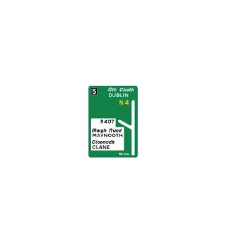
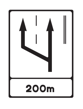
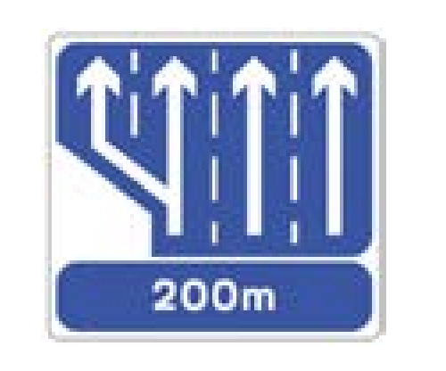
Advance Direction Signs
Advance direction signs are placed well before a junction so you have time to plan your lane position and manoeuvre safely. They show the destination, route number, and — on higher-speed roads — the distance to the junction. On motorways a standard sequence of advance signs leads up to every exit.
National Road Direction Signs
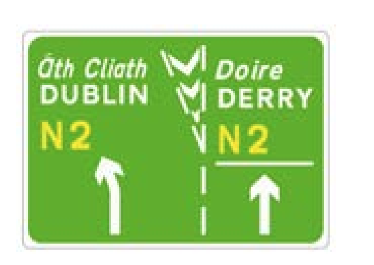
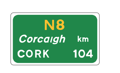
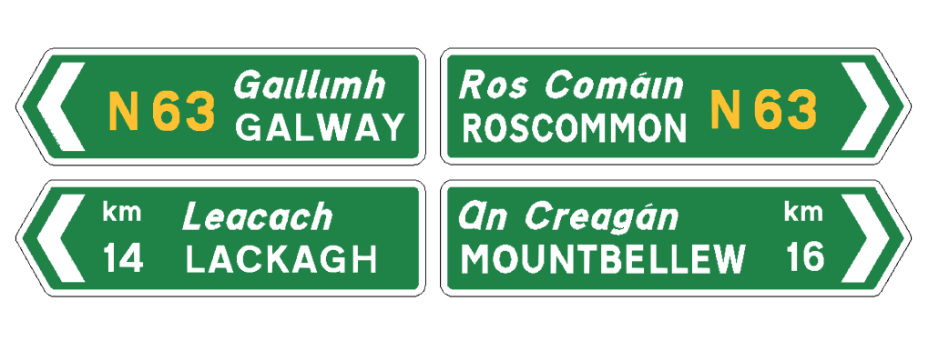
Green — National RoadsNational road direction signs have a green background with white text and yellow route numbers. They are used on national primary roads (N1–N33) and national secondary roads (N51 onwards). National primary roads are the main arterial routes connecting Ireland's cities and towns. National secondary roads connect major towns to the national primary network.
Regional & Local Road Direction Signs
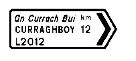
White — Regional & Local RoadsRegional and local road direction signs have a white background with black text. Regional road numbers (R100–R999) appear in a distinctive oval or rectangular badge on the sign. Local road signs (L-prefix) typically show place names only without a route number. These signs are most common in rural areas, villages, and on approach roads to towns.
Learning to drive in North Dublin?
BP Driving School covers Swords, Malahide, Portmarnock, Santry, Raheny and surrounding areas.
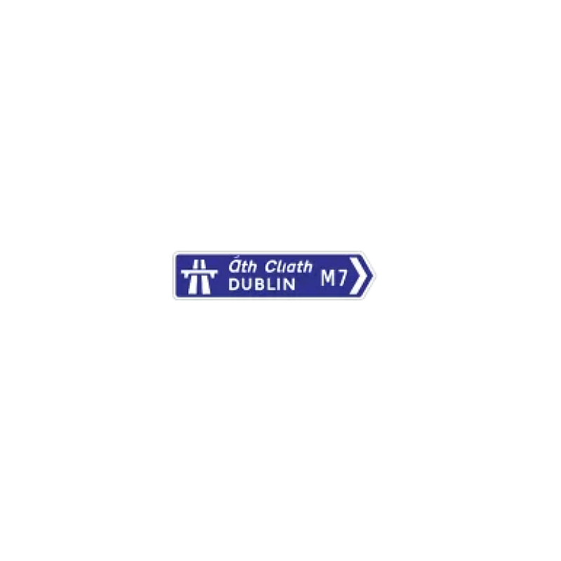
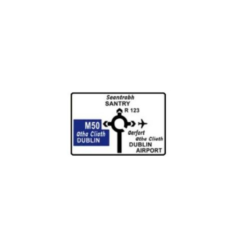
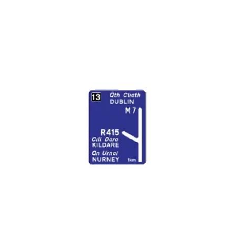
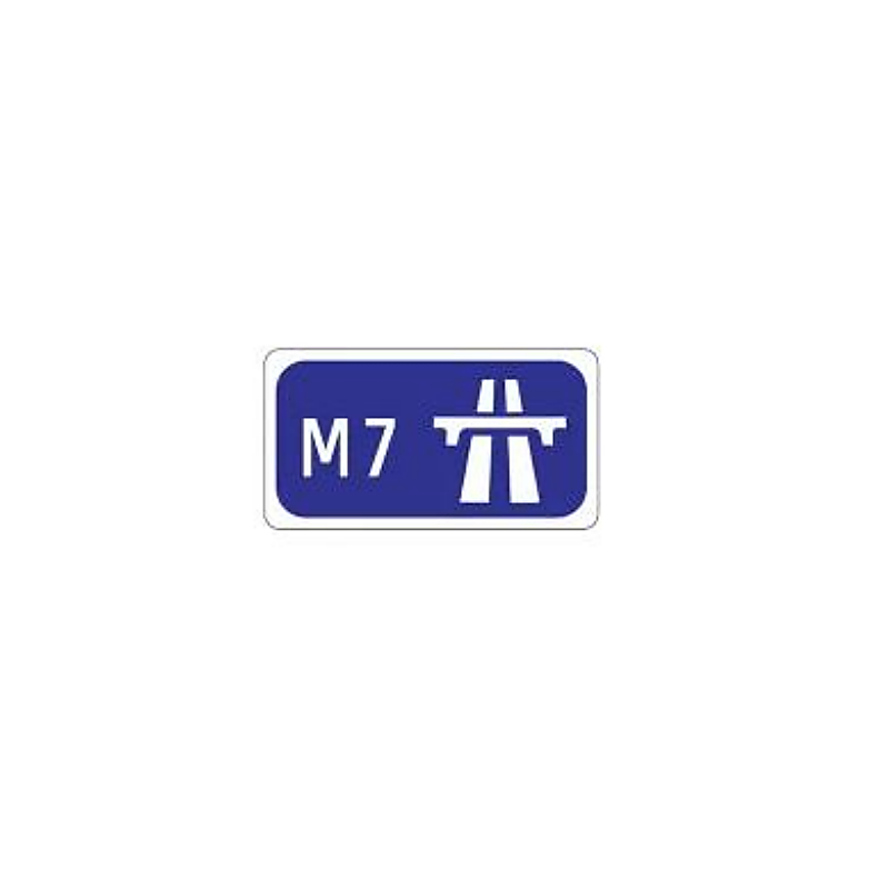
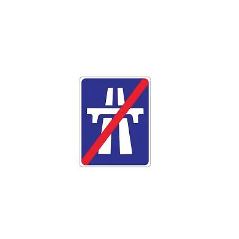
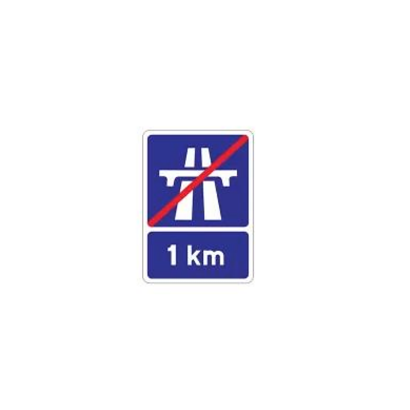
Motorway Direction Signs
Blue — MotorwayMotorway direction signs have a blue background with white text. They are used exclusively on motorways (M-prefix roads) and on the approach roads leading to motorways. They follow a structured sequence to guide you to your exit well in advance. Learner permit holders are not permitted on motorways without an RSA-approved instructor, but you must still know motorway signs for the theory test.

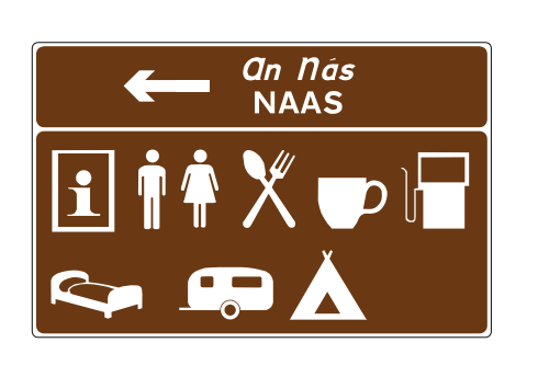
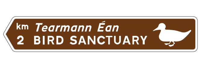
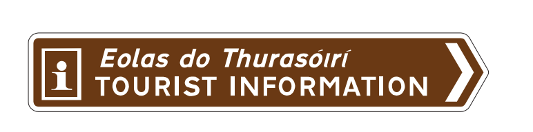
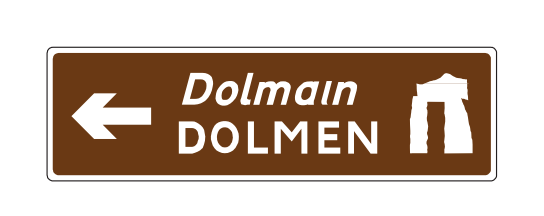
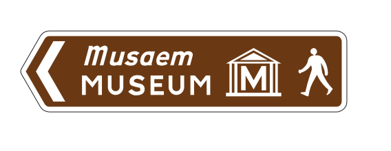
Tourist & Heritage Signs
Brown — Tourist & HeritageTourist and heritage attraction signs have a brown background with white text and symbols. They are used internationally to identify points of interest — and in Ireland they are managed by Fáilte Ireland and Transport Infrastructure Ireland. Brown signs do not impose legal obligations; they simply guide visitors to attractions.
Advance Information Signs
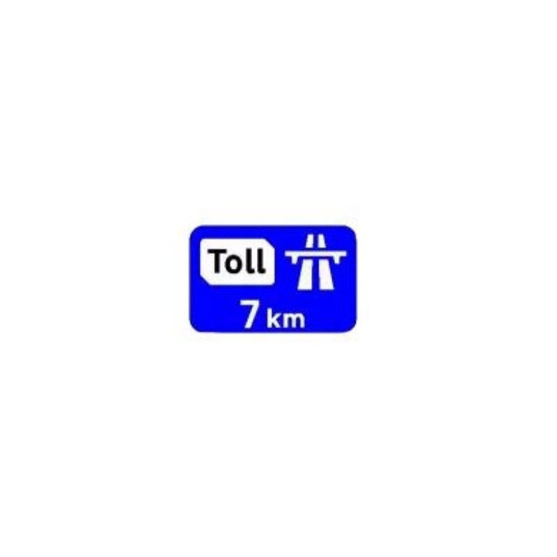
Advance information signs provide drivers with information about road conditions, restrictions, or services ahead — giving them time to prepare before reaching the point in question. They appear in various colours depending on what they relate to.
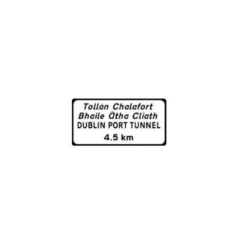
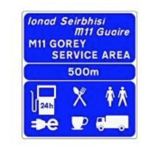
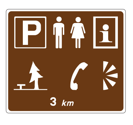
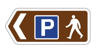
Service & Facility Signs
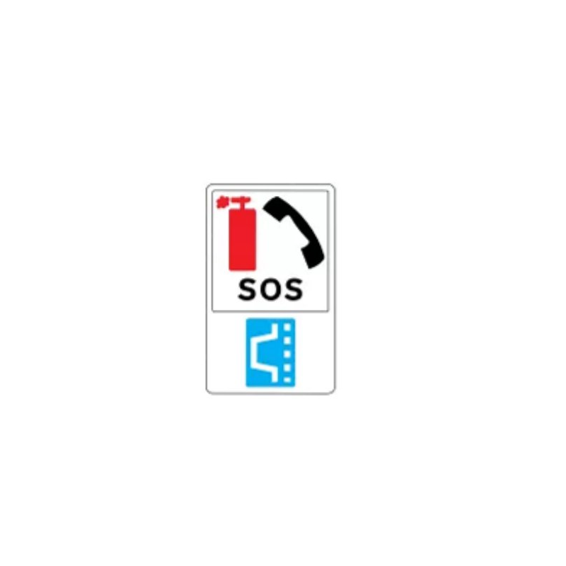
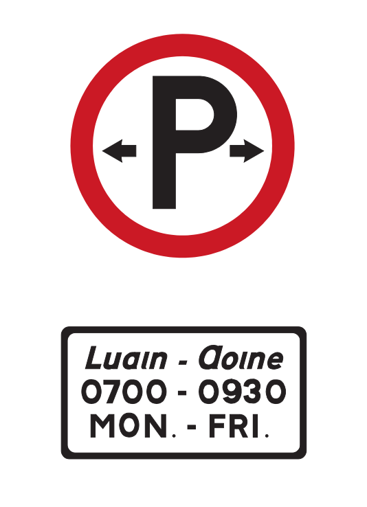
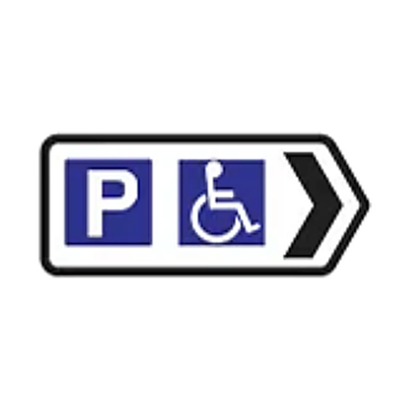
Service and facility signs point drivers to useful facilities — hospitals, parking areas, lay-bys, SOS call points, and other services. They are rectangular and typically use a blue or white background. These signs do not impose legal obligations but provide important safety information.


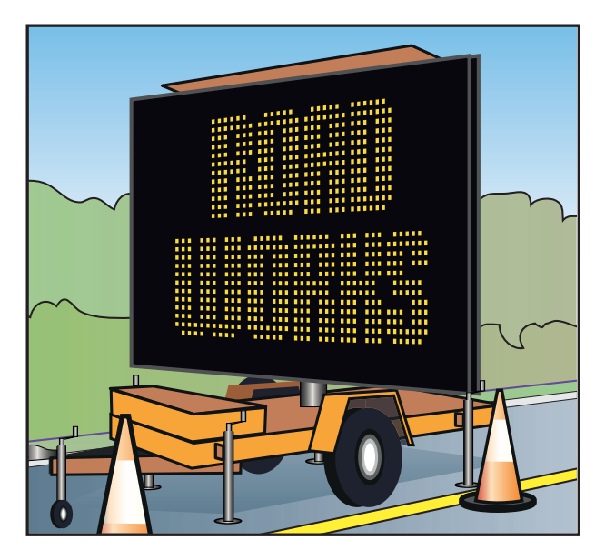
Variable Message Signs (VMS)
Variable Message Signs (VMS) are electronic signs that can display changing information in real time. They are controlled by the National Roads Authority (TII) through the National Traffic Control Centre and respond automatically to traffic conditions, incidents, weather, and planned events. VMS are particularly common on the M50, M1, M7, and M8.
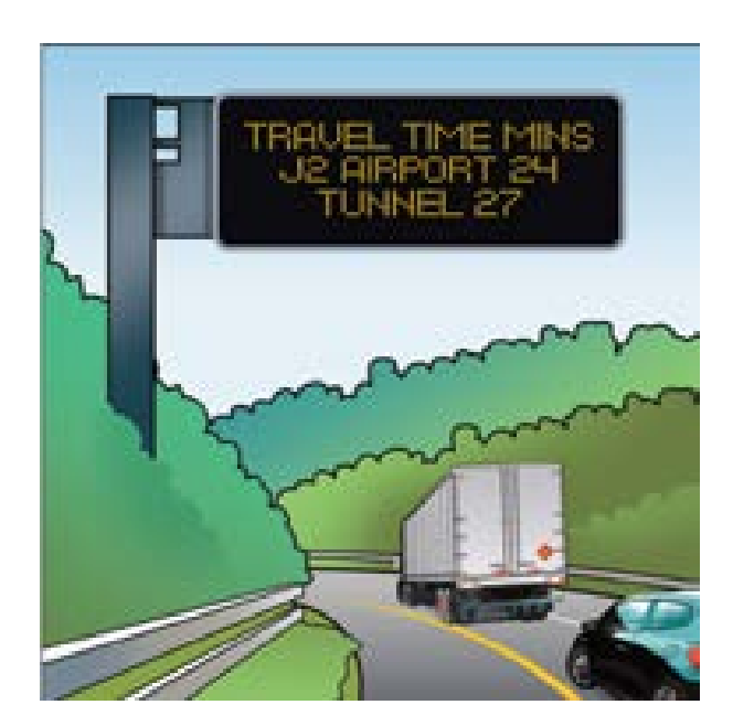
VMS can display a wide variety of messages — and the key point for every driver is that any regulatory instruction displayed on a VMS carries the same legal force as a fixed sign. The most common VMS messages you will encounter include:
| VMS Message Type | What It Means | Legal Force? |
|---|---|---|
| Speed limit (e.g. 60 km/h) | A temporary speed limit applies to this section of road | Yes — must be obeyed |
| Lane closed (X symbol) | The lane beneath this sign is closed — you must move out | Yes — must be obeyed |
| Lane open (green arrow) | The lane beneath this sign is open to traffic | Yes — confirms lane is available |
| Travel time information | Estimated journey time to a destination ahead | No — advisory only |
| Incident ahead warning | Alerts drivers to an accident or obstruction ahead | No — advisory only; but normal rules apply |
| Chevrons (directional arrows) | Guide traffic around a mobile obstruction or during roadworks | Yes — must follow direction indicated |
| Fog / ice warning | Hazardous weather conditions ahead | No — advisory; but duty of care applies |
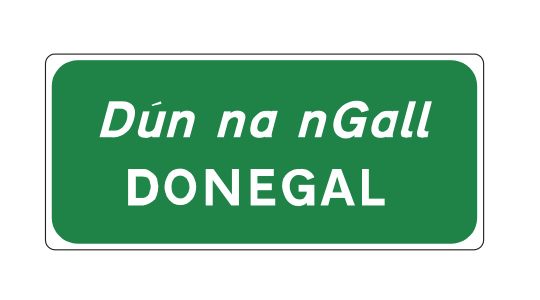
Bilingual Signs — Irish & English
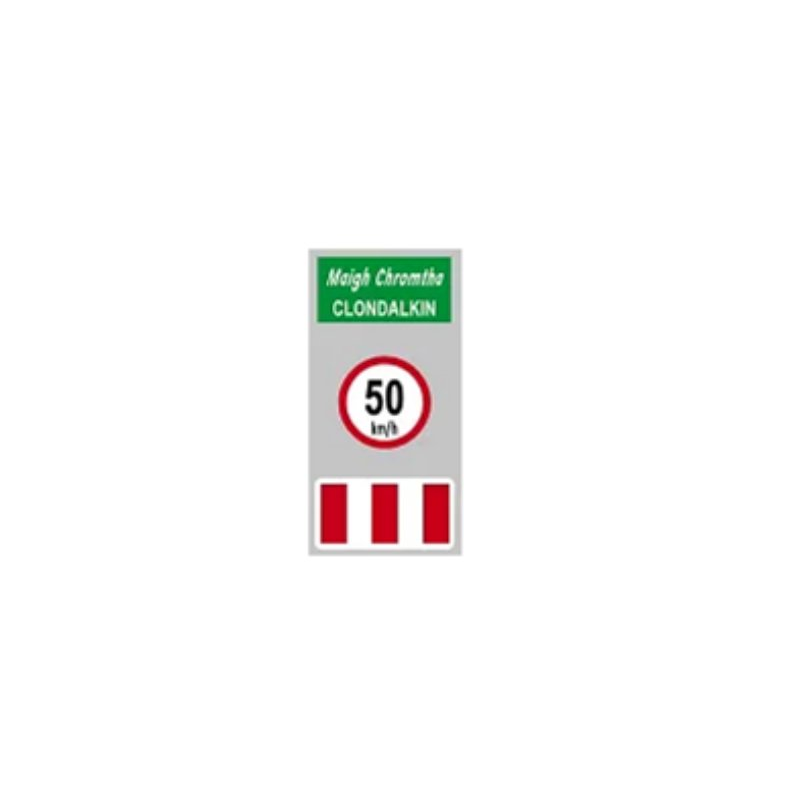
Direction signs in Ireland are bilingual — destination names appear in both Irish (Gaeilge) above and English below. In Gaeltacht areas (Irish-speaking regions — primarily in Galway, Mayo, Donegal, Kerry, and Cork) signs may appear in Irish only. As a driver, you must be able to recognise the destination you are looking for in both languages.
| English | Irish (Gaeilge) | English | Irish (Gaeilge) |
|---|---|---|---|
| Dublin | Baile Átha Cliath / Áth Cliath | Cork | Corcaigh |
| Galway | Gaillimh | Limerick | Luimneach |
| Waterford | Port Láirge | Kilkenny | Cill Chainnigh |
| Swords | Sord | Drogheda | Droichead Átha |
| Naas | An Nás | Dundalk | Dún Dealgan |
| Airport | Aerfort | Port / Harbour | Port / Calafort |
| Town Centre | Lár na Cathrach / Lár an Bhaile | Hospital | Ospidéal |
Quick-Reference Colour Guide
| Colour | Road / Sign Type | Road Prefix | Default Speed (outside built-up areas) | Example Routes |
|---|---|---|---|---|
| Blue | Motorway | M | 120 km/h | M1, M50, M7, M8, M11 |
| Green | National primary and secondary | N | 100 km/h | N1, N2, N7, N11, N25 |
| White | Regional roads | R | 80 km/h | R132 (Swords), R100s, R800s |
| White | Local roads | L | 80 km/h | Rural back roads, L1000+ |
| Brown | Tourist & heritage attractions | — | Varies | Newgrange, Kilmainham, Cliffs of Moher |
Theory Test Tips for Information & Direction Signs
Information and direction signs appear in the RSA Driver Theory Test, though typically less heavily than warning and regulatory signs. Here is how to approach them in your revision:
- Colour is the key question: The most common theory test question on information signs asks you to identify what colour a sign should be for a given road type, or to identify what type of road a sign relates to from its colour. Learn: blue = motorway, green = national, white = regional/local, brown = tourist.
- VMS legal status: A common theory test question asks whether a speed limit shown on a VMS is legally enforceable. The answer is yes — it carries exactly the same legal force as a fixed speed limit sign.
- Route numbers tell you the road type: M-prefix = motorway. N-prefix = national. R-prefix = regional. L-prefix = local. This is tested directly — given a road number, what is the default speed limit?
- Advance direction signs: Know that advance direction signs are placed before junctions to help you choose your lane. The distance shown on the sign tells you how far you are from the junction. Plan your lane position from the 500 m or 300 m sign — not the 100 m sign.
- Bilingual destinations: The theory test may show an Irish-only destination name and ask you to identify it. Know the Irish for Dublin (Baile Átha Cliath), Cork (Corcaigh), Galway (Gaillimh), and Limerick (Luimneach) at a minimum.
Information Signs on the RSA Driving Test
Information and direction signs affect the RSA driving test in a different way from warning and regulatory signs. They do not impose legal obligations, but they are directly relevant to navigation — and navigation errors can create dangerous situations.
- Lane choice at junctions: The most important use of direction signs on the driving test is for lane selection. If you are in the wrong lane at a junction because you missed or misread a lane destination sign, you may cut across traffic to correct your position — which is a serious fault. Always read advance direction signs early and position yourself correctly well before the junction.
- VMS on the test route: If a VMS displays a reduced speed limit on your test route, you must comply with it. The assessor is aware of current VMS instructions on the route. Ignoring a VMS speed limit is treated the same as ignoring a fixed speed limit sign.
- Speed limit change ahead signs: When you see an advance speed limit change sign, the assessor expects to see you begin reducing your speed in good time — not braking sharply at the point where the new limit applies. Smooth, anticipatory speed reduction is what demonstrates good driving.
- Motorway signs (if applicable): If your test route includes a motorway section, you must follow exit signs correctly and position yourself in the exit lane early. Missing a motorway exit during the test is a navigational error but not an immediate fail — the assessor will redirect you. However, lane-cutting to reach a missed exit is a serious fault.
Frequently Asked Questions
Continue in the Road Signs series
Reading direction signs correctly under pressure on real Dublin roads is a skill that comes with practice behind the wheel. Book your EDT lessons with BP Driving School — RSA-approved, Swords, door-to-door pickup, manual & automatic.
Preparing for your test? Book a mock test to check your readiness before the real thing.